0 £0.00
products in your basketto quote Checkout
Ooops no items were found.
Try something else.
Ok
Loading…

Aeroimage Playmat

Category Maps & Compasses
HE1535159

Aeroimage Playmat

Product Code: HE1535159
Category Maps & Compasses

Cover Colour: please select

Page Colour: please select

Size: please select

Page Ruling: please select

Number of Sides: please select

Lamination (Additional fee may apply):

Custom Print (Additional fee may apply)

Inside Cover Print:

Outside Cover Print:

Description

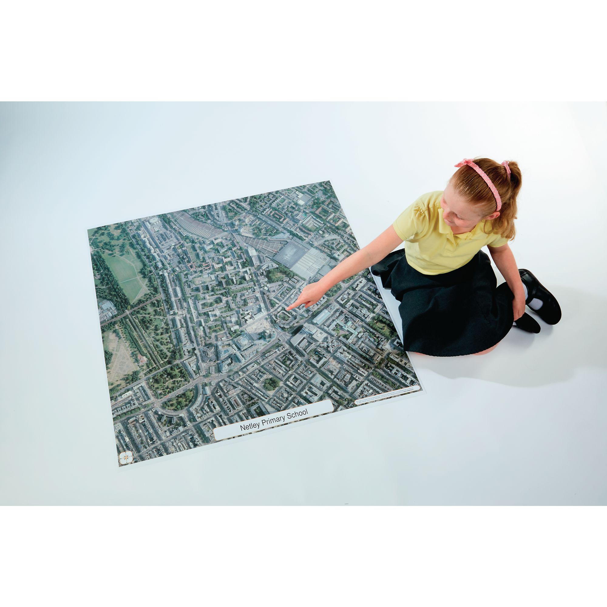
The wildgoose Aero Image Playmat provides an engaging way for pupils to explore their local area through a detailed aerial photograph, supporting geography and locality studies. Ideal for classroom activities, it helps learners develop map-reading and spatial awareness skills relevant to the curriculum. Suitable for use on the floor, desk, or as a wall display, it is tailored to your chosen school or area within England, Wales, or most of Scotland.

  • Printed on durable, fully encapsulated PVC for long-lasting use

  • Measures 1 m x 1 m

  • Centred on your school postcode or specified local area

  • Suitable for ages 5 and above

  • Rolls up for easy storage

  • Pack includes one playmat

Please note - We are not able to create products outside of Mainland UK, including maps for Northern Ireland and Isle of Man.

Specifications

UNSPSC Code

60141303

Height

100in

Width

100in

Length

1000in

Brand

Findel

Categories

Geography

Call for price
Starting from
£104.95
- +

Cover Colour: please select

Page Colour: please select

Size: please select

Page Ruling: please select

Number of Sides: please select

Lamination (Additional fee may apply):

Custom Print (Additional fee may apply)

Inside Cover Print:

Outside Cover Print:

Aeroimage Playmat

Category Maps & Compasses
HE1535159

Aeroimage Playmat

Product Code: HE1535159
Category Maps & Compasses
Call for price
Starting from
£104.95
- +

Description

The wildgoose Aero Image Playmat provides an engaging way for pupils to explore their local area through a detailed aerial photograph, supporting geography and locality studies. Ideal for classroom activities, it helps learners develop map-reading and spatial awareness skills relevant to the curriculum. Suitable for use on the floor, desk, or as a wall display, it is tailored to your chosen school or area within England, Wales, or most of Scotland.

  • Printed on durable, fully encapsulated PVC for long-lasting use

  • Measures 1 m x 1 m

  • Centred on your school postcode or specified local area

  • Suitable for ages 5 and above

  • Rolls up for easy storage

  • Pack includes one playmat

Please note - We are not able to create products outside of Mainland UK, including maps for Northern Ireland and Isle of Man.

Specifications

UNSPSC Code

60141303

Height

100in

Width

100in

Length

1000in

Brand

Findel

Categories

Geography


SEARCH ×